
Description
Geography
Cultural
aspects
Biodiversity
Main
attractions
Activities
allowed
Existing
facilities
Documents and
recommendations
How to get?
Antisana is a majestic and mysterious volcano on the western mountain range. It is the nucleus of this protected area in which we find moorlands and western Andean forests. Volcanic activity, glacial processes, and evolution have created amazing scenery along the way and a very diverse wildlife. Mirroring the volcano we find the Mica lagoon, where part of the water of Quito comes from. Aside from the lagoon there are also swamp areas where water collects during rainy season, forming seasonal lagoons such as Santa Lucia or Mauca Machay. There are several rivers that are born within the reserve which then slide through the western slopes and feed the rivers Coca and Napo; in the valley of Tambo there are hot springs. A few years ago it was a difficult place to access, but now it is one of the easiest places to visit from the capital and other surrounding areas.

From Quito
To Mica. Take the Quito-Sangolqui-Pintag road. From the central park of Pintag continue going on the road to the Antisana volcano (suitable for any kind of vehicle) until you reach the control site of La Mica that is located 35 kilometers or 45 minutes of travel from Pintag.
To Tambo. Take the route Quito-Papallacta (75 km) until you reach the Valle del Tambo community, 5 kilometers before Papallacta, from where you connect to the “Ruta del Condor” and the control booth of the reserve.
Av. Antisana 1580 y Gral. Píntag. Píntag. Pichincha Province.
(02) 238-4641.
Environmental Communication Center Baeza. Gil Ramírez Dávalos y 12 de Febrero. Baeza. Napo Province.
(06) 232-0605.

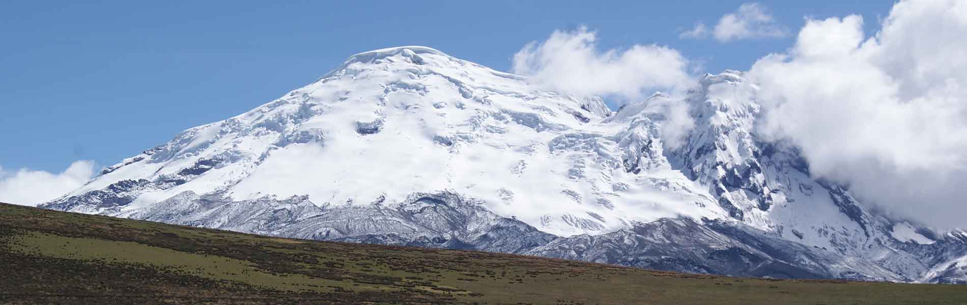
Antisana volcano is the heart of this reserve. The scenery of this reserve and that of the neighboring National Park Cayambe-Coca are marked by the volcanic activity of Antisana. Antisana´s last eruption was a lateral eruption and it happened on the Muertepungo crater 300 years ago, known as “reventazon de Antisana” (Antisana´s burst) and it spilled most of the lava that can be observed when going up to La Mica lagoon. The volcanic rock piles that are found within the area and on its surroundings testify to its volcanic activity. After eruptions lava flows eventually solidified and has left permanent marks in the scenery. The flow of mud or 'lahares', resulting from the violent melting of ice during eruptions, have also allowed for the formation of special vegetation with areas covered in lichens in the middle of grasslands.
Micaloma (La Mica area). It is a 3 kilometer hike that takes you through the surrounding areas of La Mica lagoon. You can observe the variety of birds and flora along with beautiful scenery of the moorlands. Low difficulty.
Gallaretas (La Mica area). Trail of 1 kilometer to observe La Micha lagoon, snowcapped volcano Antisana, and the flora and fauna of the lagoon. Low difficulty.
Patourco (La Mica area). Trail of 1.4 kilometers that offers another perspective of the La Mica lagoon and its beautiful scenery. Low Difficulty.
Jumandy Trail (Guacamayos area). Trail of 2 kilometers of medium difficulty. You get the chance to get to know the cloud forest, beautiful scenery and a variety of birds and mammals.
Paso o Ruta del Condor trail (El Tambo area). This trajectory is of approximately 50 kilometers and of advanced difficulty; it runs from the Valle del Tambo community to the Parque Nacional Cotopaxi (National Park Cotopaxi), crossing near the Tuminguina lagoon, the skirts of Antisana volcano, and beautiful moorlands scenery. For this trekking it is indispensable to have the assistance of a specialist tour guide (available in El Tambo community).

A large portion of the moorlands of Antisana was located on pre-Incan ethnic territory and were part of big ranches during colonial times. It is only a few years ago that the lands belonging to these ranches were integrated to the Sistema Nacional de Areas Protegidas (National System of Protected Areas) thanks to the creation of this ecological reserve. The main activity on these estates was related to the textile industry. The sandy areas that can be seen on the flatlands of the moorlands are the result of thousands of sheep that grazed here for many years. Today there are almost no sheep to be found within the reserve, only cattle and wild horses remain and they serve as food for the Andean condor and other native fauna species. The surrounding communities are engaged mainly in agriculture and livestocking. Tourism and research have replaced extensive ranching, and the complex hydrology of the area is now used to take water from the Mica lagoon and service the south area of Quito.
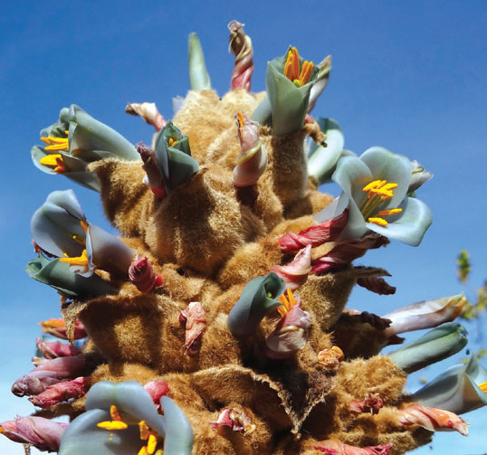
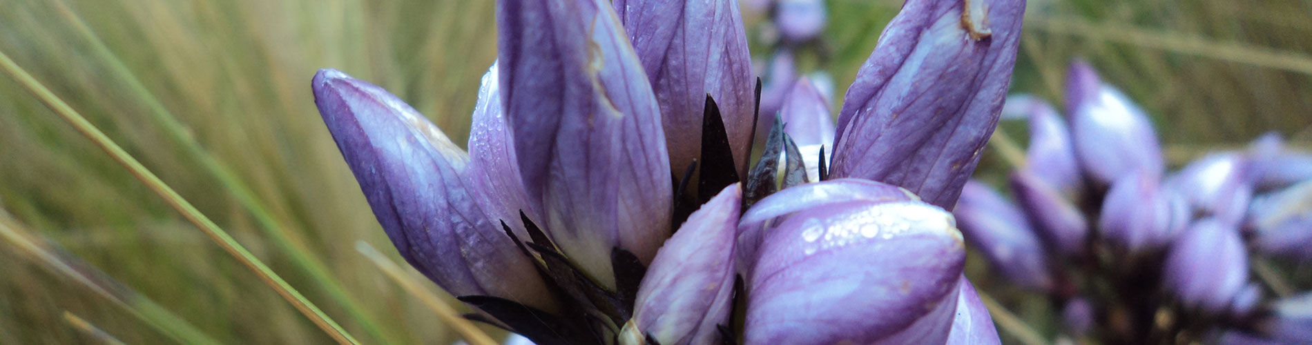
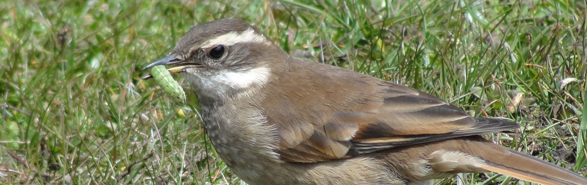
The level biodiversity within the reserve is notable: 418 bird species, 73 mammals and 61 amphibians and reptiles. The reserve has its own species of amphibian, Antisana´s osornophryne, a miniature brown toad that lives among the rocks of the moorlands, very rare to find and in danger of extinction. In the moorlands also dwell spectacle bears, white tail deer, dwarf deer, goat-deer, pumas, Andean cats, wolves, condor, curiquingues, Andean seagulls, mountain tapires, and lizards.

Antisana Volcano (5,758 m)
Antisana volcano is without a doubt one of the most beautiful and unique elevations of Ecuador. It is very wide and both of its summits are covered with snow almost all the time. The volcano is surrounded by huge extensions of moorlands that start close to the town of Pintag west of Quito.
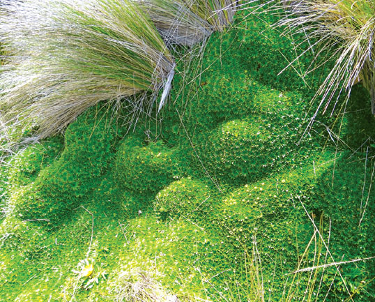
Almohadillas Moorlands
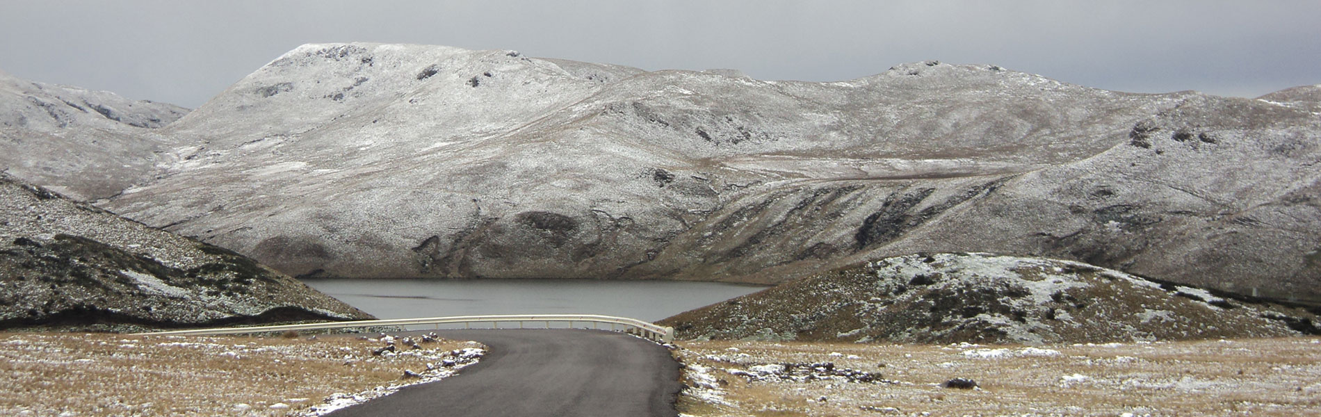
Every volcano in Ecuador has moorlands, and each one of them has special characteristics. In the case of the Antisana moorlands, there are extensive moorlands with almohadillas. These are small plants that grow in dense colonies and generate a microclimate a little warmer that the surrounding one (that is usually very cold). For this reason, a “bio-thermal dome” is formed and it produces a small but constant flow of heat to keep the roots and young trunks warm.
La Mica Lagoon
It is of glacial origin and it is currently dammed, because the Empresa Municipal de Agua Potable de Quito (Quito´s Potable Water Municipal Company) built a reservoir thanks to which a fourth of the capital´s population is supplied with water. The lagoon is an spectacle that mixes the dam´s engineering with nature's beauty, given that in its cold but nutritious waters ducks, chupiles and gallaretas swim. Seagulls, ligles, bandurrias and some migratory birds such as long legged plovers and straight beak sandpipers fly and nest in the surrounding areas.


Clothing. Warm clothes, water poncho or water resistant sweater in case of rain or drizzling. Appropiate shoes, walking boots in case of long and medium hikes.
Sport Fishing. If you wish to fish at La Micha lagoon, you must contact the protected area´s personnel to reserve a spot and review regulations.

