

Description
Geography
Cultural
aspects
Biodiversity
Main
attractions
Activities
allowed
Existing
facilities
Documents and
recommendations
Videos
How to get?
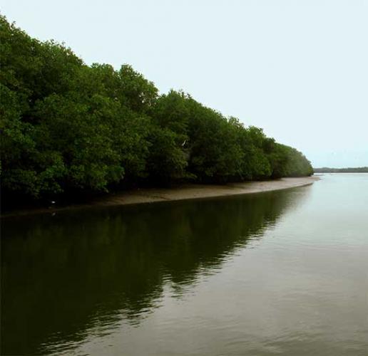
Despite the existence of mangroves along all the estuaries across the coast, each area is different and has its own characteristics. The ones you'll find here heavily influenced by the salty waters of the Pacific Ocean. The refuge is located at the north of the Gulf of Guayaquil, near Puna island, where the channel (or stream) El Morro starts. Among the main reasons for its declaration as a protected area are the existence of a large population of dolphins that live in the channel of El Morro and the colony of frigatebirds of Manglecito island.

From Guayaquil. Take the coastal road up to El Progreso, from where you head south, toward General Villamil, also known as Playas (93 km). From there, take the road that passes through Playa - El Morro - Puerto El Morro for 20 kilometres to reach the entrance of the shelter.
Malecon Street, Precinct Puerto El Morro. Guayas Province.
There is no phone here; for more information contact the offices of the Guayas Regional Directorate of Environment (04) 232-0391 / (04) 232-0383.

The area is divided into two sections. The mainland covers 2,094 hectares around the estuaries of El Morro and El Salado; the insular part covers about 8,000 hectares and includes the islands Manglecito the Farallones rock formations, Morro canal and the water around it . Morro canal’s is a narrow passage located between the island and the mainland Puna, is 3 kilometres wide and provides a path for ships to the Gulf and the port of Guayaquil.
In Puerto El Morro there are two piers where boats set sail for aquatic tours.
For the The Manglecito Island or Isla de Pajaros route, you'll depart on a guided tour from Puerto El Morro and arrive at the island which is 8 kilometres from the port. On the tour you can see dolphins and marine life.
On the Morro Canal route, the boat starts from Puerto El Morro and travels 15 kilometres to the entrance of the Canal del Morro. You can watch the dolphins and see the coastal mangrove ecosystem. It requires a guide for travel. There are community cottages where you can lodge in the Puerto El Morro area of the refuge.

Several area located in the vicinity of the El Morro and the great El Salado estuaries were not spared from the advent of shrimp-farming that occurred in past decades. However,as shrimp farming has decreased at the national level and now that the areas around the El Morro estuary has been declared protected, the mangroves are recovering. Local communities that live adjacent to the refuge are the traditional inhabitants of the mangrove; they depend on fishing and collecting shells and crabs species to survive. Since the area became a reserve, and as tourism increases in the reserve, local people are also involved as service providers, renting boats or working as local guides.
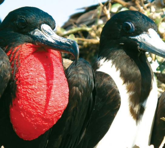
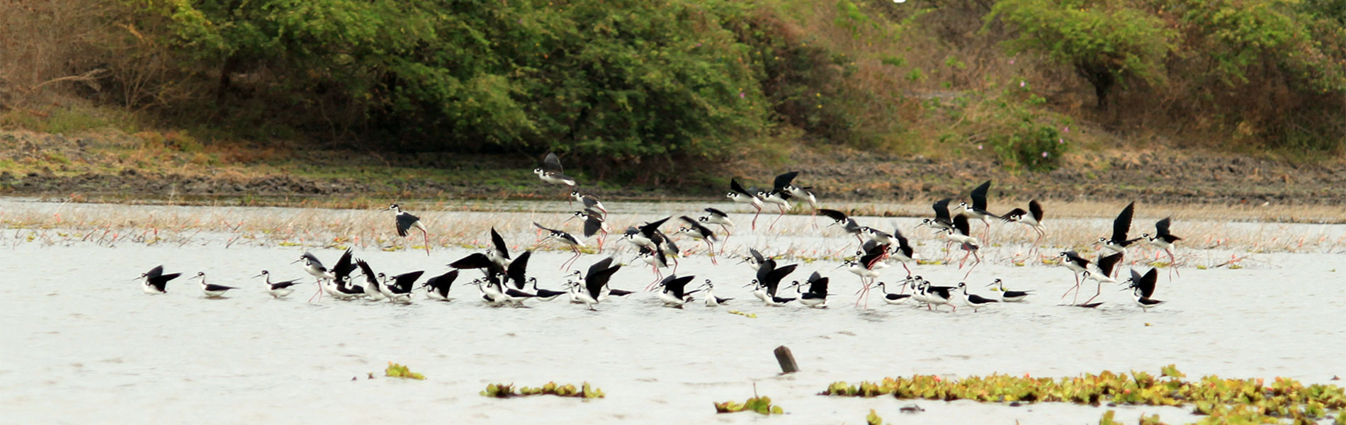
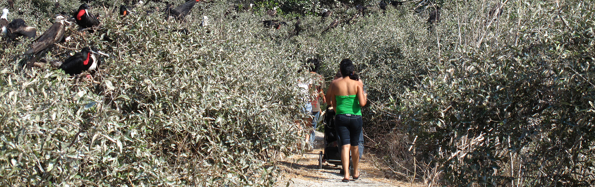
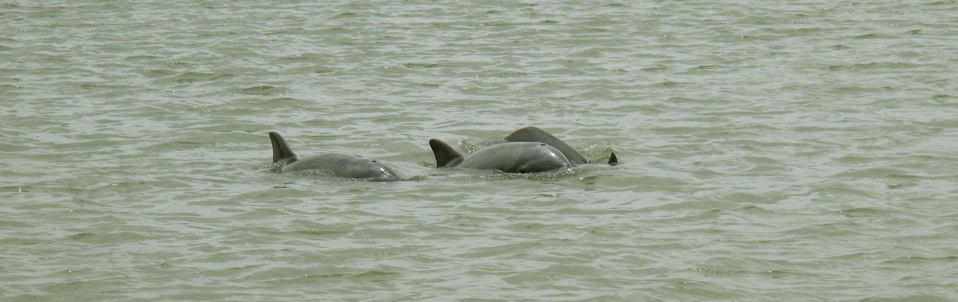
The mangroves in the protected area are subject to the daily wash of the tides. There are four types of mangroves: red mangroves, characterised by their large and long stilt roots; white mangroves, which have bell-shaped flowers and green cup-shaped fruit; the Jeli mangle or button, named after the round shape of its fruit and small greenish flowers, and black mangroves, also with small flowers and triangular fruits which when they fall to the ground become fixed in the mud to germinate. On land, the refuge protects a small patch of arid woodland, which is typical of Ecuador's coastal region, where you'll find plum trees, Guasango, Ceibo, the Nigüito, the Guachapelí, the Algabarro and Saman. There is plenty of birdlife that is easy to spot; about 80 species have recorded, being the most abundant seabirds and shorebirds . On the Manglecito island there are roosting and nesting sites of frigatebirds, pelicans and blue-footed boobies. It is estimated that the frigatesbird colony is 6,000 strong, making it one of the greatest concentration of the species in Ecuador. At Farallones, at the entrance of the estuary ,there are colonies of blue footed boobies and pelicans. The other regular visitor to the refuge is the common dolphin . The best places to see them are the Farallones opposite Posorja, at the entrance to El Morro, the Estero Lagarto, the estuary El Morro, La Islita and Boca Posorja.

Dolphin watching
These marine mammals have a habit of accompanying or escorting the boats that make their way along the channels. The most convenient time to observe them is at middle-tide, and less often, when the tide is low.
Manglecito island and seabird colonies
These marine mammals have a habit of accompanying or escorting the boats as they make their way along these channels. The most convenient time to observe them is at middle-tide, and, less frequently, when the tide is low.
Manglecito island and seabird colonies
The frigatebird colony can be seen on Manglecito island in the north and at the Ayalán estuary at El Continente. In Farallones there are pelicans and blue-footed boobies and in the La Islita in El Morro the estuary you'll find roseate spoonbill, white ibis and cormorants.


Clothing. Light clothing and comfortable shoes, the visit is a canoe tour that doesn't make stops.

