

Description
Geography
Cultural
aspects
Biodiversity
Main
attractions
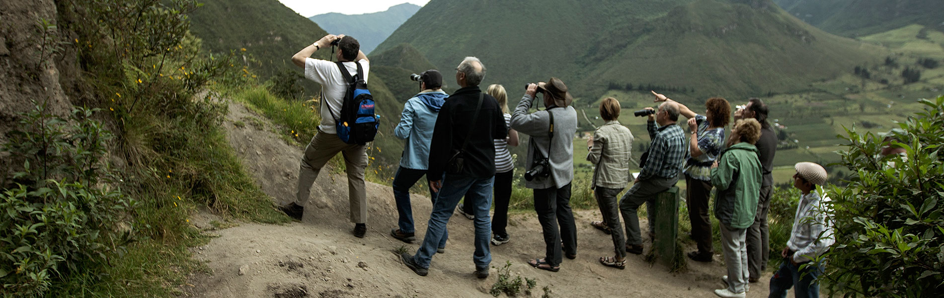
Activities
allowed
Existing
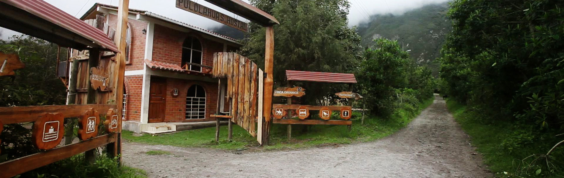
facilities
Documents and
recommendations
Videos
How to get?
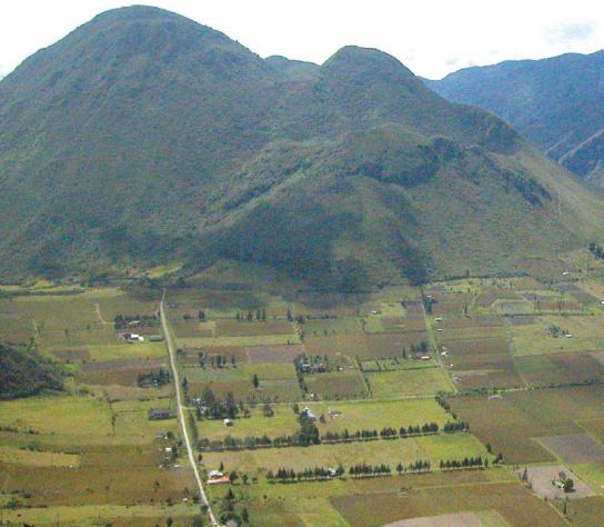
Pululahua is a calm and isolated place that´s close to the city of Quito. Every afternoon the life that this cauldron has is hidden with a white coat from moisture-laden clouds that arrive from the Pacific´s coast. This is the only protected area of the country under the category of “Geobotanical Reserve”. This speaks volumes aof the area's geology and volcanic history are very unique. Aside from the wealth of flora that grow on its slopes and ravines, the reserve protects something very unique worldwide: an inhabited volcanic crater that is located very close to the equator itself. Without a doubt, the energy of the earth is felt in every rock and in every cloud that comes in and out of the Pululahua volcano.
From Quito
Acces through Ventanillas. Take the routhe Quito-Calacali. 6 kilometers from the Monumento a la Mitad del Mundo (Monument of the Middle of the World), in the area of Caspigasi (there is a gas station in this area), you take a detour to the right and continue for 1.2 kilometers towards the mirador/lookout.
Access through Moraspungo. Take the route Quito-Calacali and continue for 8 kilometers after the Caspigasi area, until you arrive to a second gas station. At 500 meters there is a dirt road on the right. After 3 kilometers you arrive at the control site of Moraspungo. From here it takes about 30 minutes to get to the crater via a winding and steep road that continues for about 12 kilometers.
Calle Eduardo Kingman Oe12-401 y Av. Manuel Córdova Galarza (sector Ventanillas, dentro de la reserva). Calacalí. Provincia de Pichincha.
(02) 239-6543

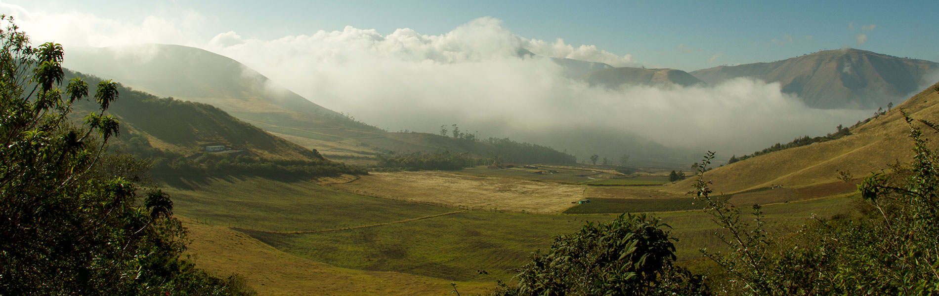
This great crater is the result of accumulated rock and landslides due to successive Pululahua volcano eruptions. The hills of Pondoña, El Chivo and Pan de Azucar (technically called volcanic domes) were created due to subsequent eruptions. Pondoña and Pan de Azucar have small craters on their summits. It is estimated that the last eruption of the Pululahua volcano happened 2,300 years ago.
In the Ventanillas area.
The reserve´s administration offices are located here as well as several other facilities: gazebo, a small artisans market, and the “Sal si Puedes” ('Get out if you Can') trail that takes you to the bottom of the crater.
Trails and Paths:
Sal si Puedes trail. Starts at the Ventamillas gazebo and it reaches the bottom of the crater. This is a winding trail of 1.8 kilometers. Estimated hiking time: 20 minutes (to descend) and 1 hour (to ascend).
El Viento trail. Paved path (of total access) of approximately 800 meters long. This path leads to the picnic area, where there are bbq grills and tables, and two cabins to spend the night. There are natural trails that lead to the hills Pondoña and El Chivo. From the guard booth, on the lower area, there are several natural winding trails that lead to the hills of El Chivo (1.3 km) and Pondoña (2.7 km).
To visit both of these trails we suggest the company of a tour guide.

Traditional settlers arrived here attracted to the fertility of these soils and the abundant humidity of the area. Within the crater there are several towns such as Niebli, Los Reales and Pululahua. During colonial times the lands that now make up part of the reserve were given to the religious order of the Dominicans, who established the Pululahua ranch. With the liberal revolution, the ranch became property of the state in 1905. Social Security handled and managed the ranch until 1979 when due to the agrarian reform the ranch was handed over to workers of the ranch. Pululahua was known for its agrarian production and for being a source of limestone used for house construction in Quito. An interesting fact is that thanks to the tenacity and the efforts of scientist Misael Acosta Solis (1910-1994), on January 28th 1966 the state declared Cerro Pondoña a National Park, making this area the first protected area of continental Ecuador. In 1978 it was changed to Geobotanical Reserve Pululahua.
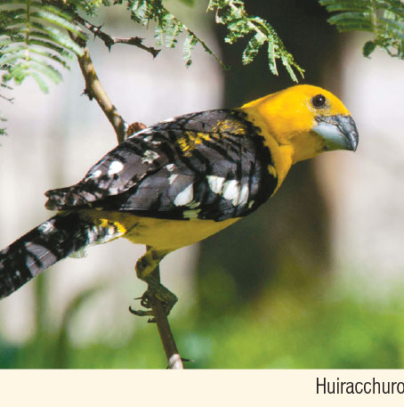
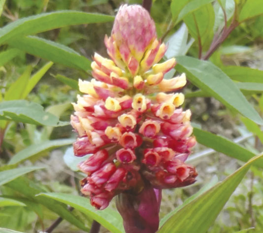
The abundant fog that enters the crater creates diverse microclimates and the development of vibrant vegetation on its slopes. Among the most common groups of plants that are found here are the bromeliads and orchids, of which there have been close to 100 species recorded. You can also observe zagalitas, zapatitos, colcas, sigses, pumamaquis, wild taxa, and allpa chocho, among others. There have been 180 bird species recorded, among which you might find the black chested buzzard eagle, quilico, mirlo, hiracchuro, several species of hummingbirds, and even wild turkeys in some areas. Among the mammals we have moorland wolves and skunks, whose evidence (faeces) can be seen when you walk the Park's trails; there are also 'soches' or small deer, squirrels, opossums, and there are even sporadic reports of spectacled bears. In the lower part of the reserve you can see armadillos and agoutis. Among the reptiles and amphibians there have been recorded three species of lizards, one of snake and two toad species.
Craters of Pululahua
The crater´s diameter measures close to 4 kilometers at its highest and 3 at its base. It has a horse shoe shape and it opens up toward the north to release the Blanco River, that flows towards Guayllabamba. You can get a great view of the whole crater from the mirador/lookout located on Ventamillas and in the recreation area of Moraspungo. There are three hills in its interior: Pondoña (2,975 m), El Chivo (2,698 m), and Pan de Azucar (2,769 m). For the first two hills there are trails that lead to the summit. Pan de Azucar, that is located to the north of Pondoña, has that name because its shape is similar to that of a loaf of bread.
Trail and recreation area Moraspungo
Given its closeness to Quito, the existing facilities on this site make it ideal for a family trip. The trail has total access (even for wheelchairs) and runs through the remains of Andean forest where you can appreciate the unique flora and fauna of the reserve. There is a picnic area at the end of the trail, where you´ll get a great view of the crater.
Other sites of interest.
Pululahua Community. Located in the agricultural area of the cauldron. Here you can do several recreational activities.
Ventanillas Gazebo. This is the closest and most accessible place to observe the scenery of the reserve.
Limestone ovens. These are very old installations located on El Bucal area.


Clothing. Warm clothes, water poncho or water resistant sweater in case of rain or drizzle.
Shoes. Appropiate shoes, walking boots for long and medium hikes.

