
Description
Geography
Cultural
aspects
Biodiversity
Main
attractions
Activities
allowed
Existing
facilities
Documents and
recommendations
How to get?
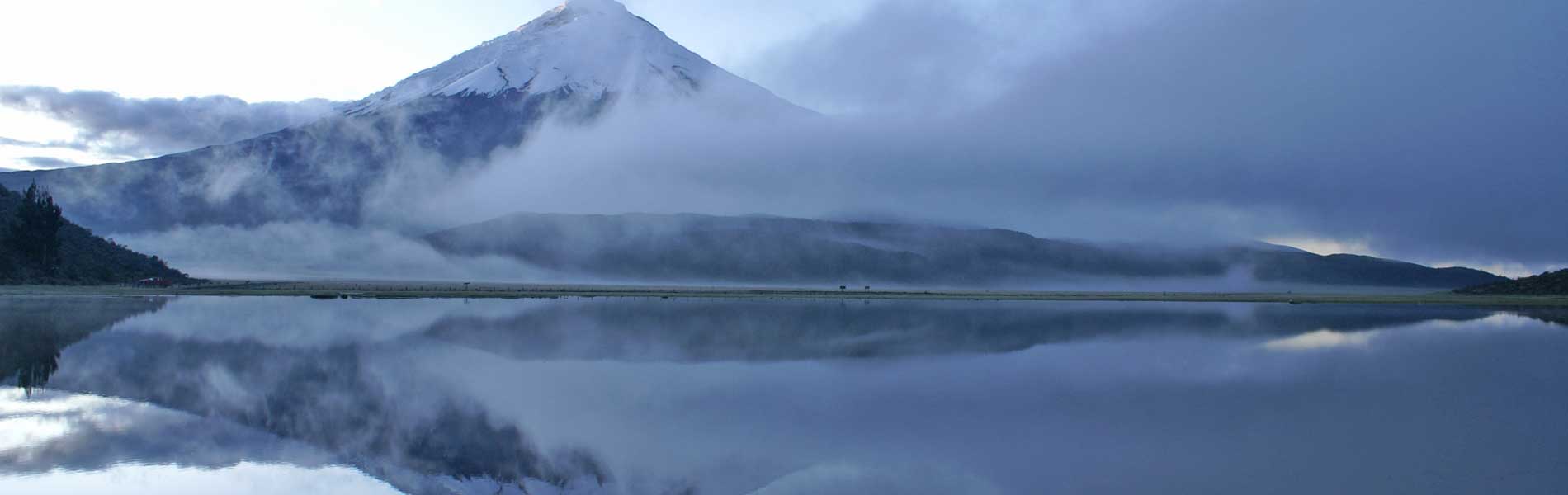
The Cotopaxi volcano, an almost perfect snow cone that rises to 5,897 meters is unique in the world and is perhaps, next to Galapagos, the greatest symbol of our natural geography, recognized worldwide.
Thousands of climbers from all nationalities have achieved its peak and many others dream of doing it. Because it is located in the center of the inter-Andean corridor and close to several cities such as Quito and Latacunga, Cotopaxi National Park is one of the most visited and where many people probably first touch snow.
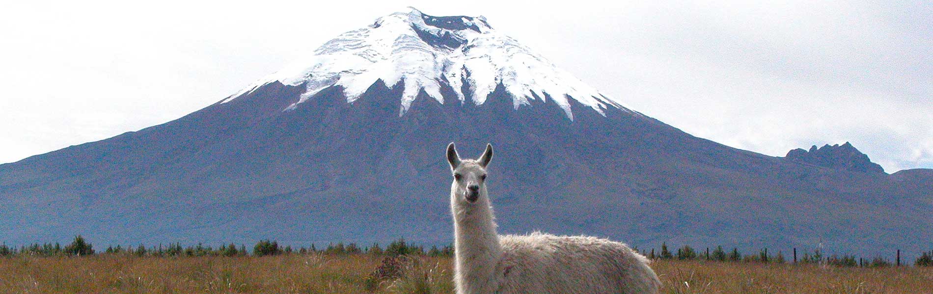
The imposing Cotopaxi, one of the highest active volcanoes in the world, dominates the landscape of the protected area, which also includes two smaller volcanoes close by; Morurco (4,880 m) and Rumiñahui (4,722 m). Cotopaxi is located in an area called "Avenida de los Volcanes"(Avenue of the Volcanoes), named by German naturalist Alexander von Humboldt in 1802 referring to volcanoes of the central and northern Ecuadorian highlands. The predominant ecosystem in the park is moorland, with its own unique flora and fauna. Vegetation is principally scrub and small, low shrubs.
From Quito
Caspi admission checkpoint: To enter the park, drive along the Panamericana Sur Highway (section Quito - Latacunga) to kilometer 42, where the detour to the entrance to the park is located. From there it is 15 minutes to get to a paved checkpoint pathway.
North admission checkpoint: take the Panamericana Highway to Machachi and then continue to the town of Güitig. From there you continue along the paved road up to the Pedregal. Within 20 minutes you get to the admission checkpoint.
Entrance of Cotopaxi National Park.
Control Caspi. Cotopaxi province.
(03) 305-3596

Cotopaxi, the second highest mountain in the country, is an active volcano and sometimes you can see volcanic venting, although its activity is never comparable to that of its neighbours, Tungurahua and Sangay. On the eastern flanks of Cotopaxi and along the Pita river, heading north, you'll find large rocks and volcanic material, following the latest eruption of the volcano which occurred in 1877. Cotopaxi is a typical example of a stratovolcano: the picture postcard idea of a volcano, more or less a regular conical shape. It is the result of the accumulation of rocks, sand and ash from successive eruptions. This material has formed the black soil you'll see on its barren slopes.
The main river system of the province is the Cutuchi River, which originates on the slopes of Cotopaxi, formed in turn by the Manzana Huayco and Rumiñahui rivers. This river then becomes the Patate which flows into the Amazon.
In the area known as Mariscal Sucre is an interpretive center that has several exhibition halls, a souvenir shop and cafe. At 4,810 meters you'll find the José Ribas shelter.
Moor Path: Exits and returns to the center of interpretation. You can see the Mishauaico channel and native species in the area. The tour is just 1 km and fairly easy.
Limpiopungo Path: This high road takes you along the edge of the lagoon. There are viewpoints for observing the landscape and waterfowl from this site: coots, ducks and gulls. From here the Rumiñahui volcano can also be seen.
Refugio Jose Rivas
From the park entrance, travel about 20 kilometers up to the parking lot under the shelter. The road is signposted and is usually not problematic. You'll get to a refuge after about an hour's walk from the parking lot, which is at 4,500 meters.
The El Refugio trail is advanced, due to the steepness of the slope. There are also areas for camping and picnics, including La Rinconada and Condorhuayco.
The reufgio is located within Cotopaxi National Park and was built by the Club de Ascencionismo del Colegio San Gabriel in the early 70s, before the declaration of the protected area. El 'MAE' in 2013 acquired the infrastructure to be able to being the renovation, which included the expansion of infrastructure by increasing space for accommodation and food, as well as restrooms, and insulation throughout. The work has been completed and has been subsidised along with facilities at El Boliche with an investment of $ 382,086.15.
Shelter Services:
- Access to clean shelters and food depending on your intended acitivites in the reserve.
- Value-added facilities to stay as part of the process prior to the coronation of volcanoes.
- Food and shelter spaces for day visitors, for those intending to explore the ice and snow.
- Artisanal handicrafts for sale. Integration of communities linked to the reserve's value chain.

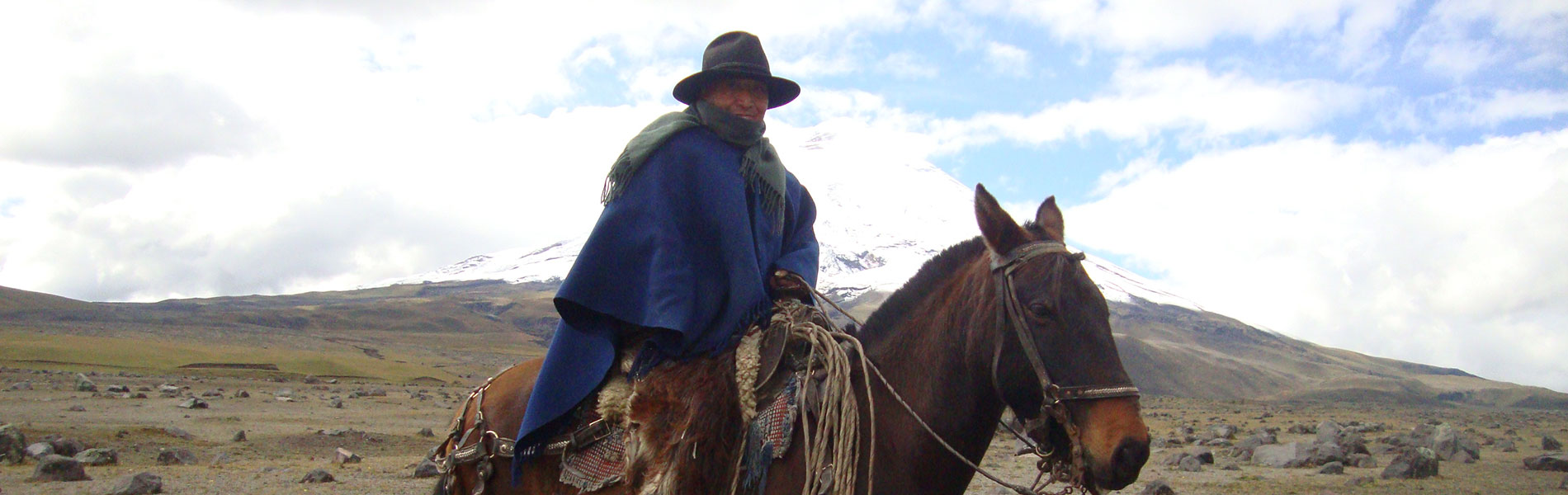
Cotopaxi is a sacred mountain for many native ethnic groups, and has always caused admiration from insiders and outsiders alike. Even if you see it every day, its majesty never becomes outdated. Its name, although people disagree, is believed to be of Kichwa origin. Accordingly, the most widespread translation states that 'coto' means neck or throat, and "paxi" refers to the Moon, so that its meaning would be "neck of the moon"
The most violent eruptions that have been reported occurred in the sixteenth and seventeenth centuries. In 1877, flows of mud and rock reached the Pacific Ocean and the Amazon, and seriously affected Latacunga and the valley of the Chillos the southeast of Quito. Tales by Sodiro and Wolf recount that:
"The momentum with which the waves rose and fell, crashing and pushing against each other, like an army of hills in uproarious battle, the shock of rocks and trees swirling in that awful storm produced a thunderous roar, and the ground shook, shaking one's spirit to many leagues away. " (Sodiro, L. 1877. Tale of the eruption of Cotopaxi on on June 26, 1877. National Press, Quito.)
"Many people can not be convinced to this day, of the great floods that disrupted the plains of Latacunga, Chillo Valley and along the Napo River, had only come from melting ice on Cotopaxi ..." (Wolf, T. 1878 . Notes: Reports on the Cotopaxi. Quito).
To protect this wild, barren ecosytem, it is very important to know how the vegetation has adapted to support itself and develop in such a harsh climate.
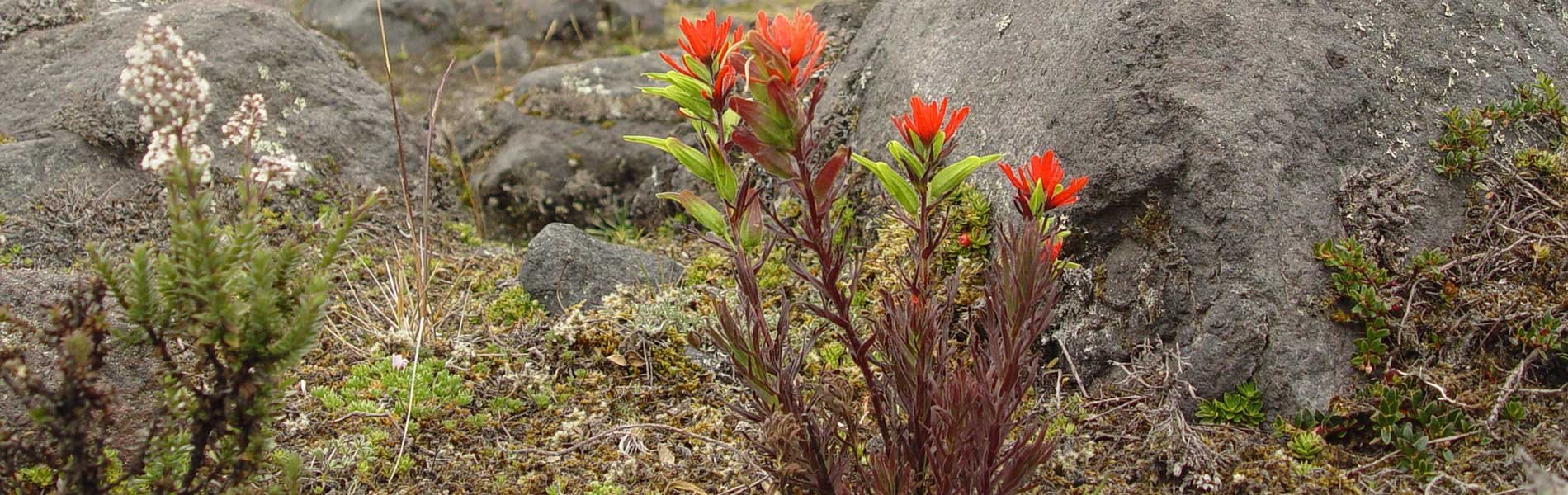
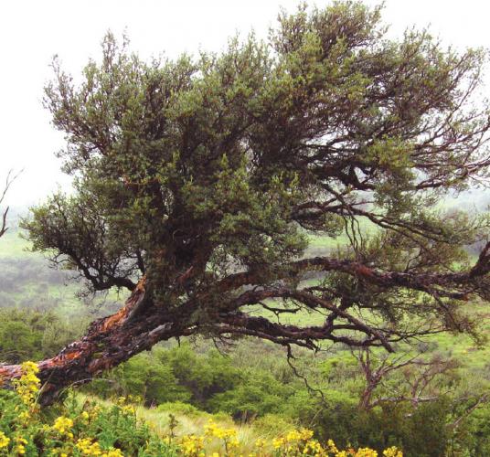
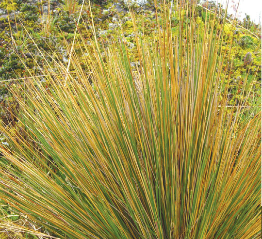
The extreme conditions of the moorland forces plants to adapt.The most adept at this survival tactic are the grasslands: plants with long thin leaves (which does not look like leaves, more like spines) do not lose as much water as the broad leaves of most common plants. The leaves die, but remain on the plant, protecting the fragile young leaves and flowers on the center of the plume. Shrubs, such as chuquiragua, have small and resistant leaves to withstand the shortage of usable water. Many plants grow as thick pads, creating an interior microclimate that protects their delicate young bodies. Stemless rosettes, such as chicory and one of the valerian, grow their leaves on the ground to keep moisture and generate heat. The few trees that you'll find (such as yaguales and kishwares) are small, hard, hairy and bright so as to protect themselves from cold and radiation,and have leaves and stems that retain heat and water. There are many herbs such as gentian, ferns and cachos de venado (literally 'deer horns'), taking advantage of the proximity to these other plants to live in the wilderness.
There is also a herb called 'Cotopaxi', asplundii Cotopaxia, and it is a member of the celery family that grows near the Limpiopungo lagoon. As you trek through this area it will be relatively easy to see rabbits, skunks and even deer and Andean weasels (known as chucuris), and hawks, pigs, quilicos and Andean gulls soaring through the sky. With luck you might see condors and mandolins. In the Limpiopungo lagoon, coots and Andean ducks bathe.
Two marsupial mammals inhabit the park, Andean foxes and marsupial mice. Other mammals include vVoles and moorland wolves moor also inhabit the area, although are difficult to spot. Marsupial frogs, cutines, lizards and guagsas add to the range of diversity.

Cotopaxi volcano
Cotopaxi also wonderful for its perfect cone shape, and brilliant mantle of perpetual snow, and for Yanasacha, a huge wall of black rock that looks like an eye, visible from the north. The crater is 800 meters in diameter and 334 meters deep.
Rumiñahui Volcano and Lake Limpiopungo: The Rumiñahui volcano is a rugged looking mountain with plenty of peaks. It pays homage to the last indigenous warrior who heroically resisted the Spanish invasion and whose name means "stone face". The peaks are walls 800 meters high surrounding the crater probably collapsed under the violent eruption of the chamber where the magma sat. Limpiopungo lagoon is located at 3,800 meters above sea level and covers approximately 200 hectares.
It does not have a clear edge as other lagoons; the ground around it is muddy. It has many reeds in which you'll find nesting ducks, as well as andean gulls and other birds that fly around the lagoon.
Valle Encantado and Pita River Canyon
On the eastern side of the park, entering via Machachi, you are the Enchanted Valley.
From here you can see the traces of the latest eruption of Cotopaxi: lahars (mudflows now covered by moss and tough shrubs) and enormous stones that were fired out of the volcano.
The Pita river runs through a channel that winds through the forests and agricultural areas outside the park, where it forms impressive waterfalls. This is one of the rivers that provide drinking water to Quito.


Clothing. Warm clothes, waterproof poncho or raincoat in case of rain or drizzle. Proper footwear, and walking boots if medium or long walks intended.
Hike to the refuge. There are people who become affected by altitude, especially during the walk from the parking lot to the refuge of Cotopaxi. Walk slowly, and make several stops for the body to get used to the altitude. If you feel dizziness or headaches, it is best to descend.

