
Description
Geography
Cultural
aspects
Biodiversity
Main
attractions
Activities
allowed
Existing
facilities
Documents and
recommendations
Videos
How to get?
Podocarpus National Park is located in an area of high biodiversity and endemism in the southern region of Ecuador. The National Park is an importnat example of mountains in tropical latitudes, which is one of the main reasonswhy Ecuador is so biodiverse. Many studies show that most of the country's biodiversity is packed into these intermediate altitudes, where the cold is not so extreme and where humidity, microclimates and geographical barriers abound. The area around Podocarpus is considered a site of global importance for biodiversity conservation.
For this reason, together with other areas such as Yacuri National Park and the Cerro Plateado Biological Reserve, the region has been part of the Biosphere Reserve Podocarpus - El Condor since 2007, a recognition awarded by UNESCO. This area is home to a large area of moorland, cloudforest and scrubland, essential for the preservation and continuity of ecosystems in southern Ecuador and northern Peru.
- Biosphere Reserve Podocarpus - El Condor (Declared by UNESCO in 2007)
- Lagunas del Compadre lake declared a Ramsar site in 2012

From Quito, Guayaquil and other cities get to the city of Loja to acess the upper parts of the park or the city of Zamora for the lowlands.
From Loja
To Cajanuma. Take the Loja - Vilcabamba road for 15 kilometers to the checkpoint. From here you continue on an unsealed road until you to reach the refuge (8.5 km).
To Bombuscaro. Take theZamora - Loja (60 km) road. From there, continue south on an unsealed road for 7 km until you reach the start of a path that leads to the park.
Sucre streets (04-55) between Quito and Imbabura. Loja. Province of Loja.
Phone: (07) 257-1534 / (07) 257-7125.
Sevilla de Oro streets and Francisco de Orellana. Zamora. Province of Zamora Chinchipe.
Phone: (07) 258-5927 / (07) 260-6606.

Podocarpus National Park is part of the Eastern Cordillera in southern Ecuador. It is an ancient mountain range, with little volcanic activity and no high peaks such as those that are so common in the north. In addition, it is an area of confluence of the coastal dry vegetation and the more humid regions of the high Andes and the Amazon, with a great diversity of species, many of them unique. The Park's isolation is thanks to depressions in the land that were creted during the ice ages of the Pleistocene; this made its flora and fauna varied and plentiful. The area's topography is steep and irregular, with torrential rivers that espace from teh mountain range and flow across the park from north to south. This complex hydrography includes important lake systems, among them the Lagunas del Compadre in the northwestern part of the park.
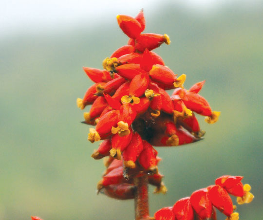
In Cajanuma there is an administrative center, a conference room, cabins and trails; in Bombuscaro there is an administrative center, cabins, trails and an orchid. Both have campgrounds and hostels
Cajanuma trails:
Oso de Anteojos is an easy 400 meter circuit that runs through the cloudforest, with plenty of flora and fauna to look at.
Bosque Nublado: a 700m route that goes around to the side of the mountain and returns to the area of the refuge. This trail allows you to to appreciate the cloud forest and has a natural viewpoint.
Low difficulty.
Los Miradores. A 5 km circuit of advanced difficulty; runs through the cloud forest and wilderness, passes viewpoints and takes you through the Loja, Vilcabamba and Malacatos valleys.
Lagunas del Compadre. This is a 14.5 km, technical trail that takes at least two days. It ends in the Lagunas del Compadre and you require a guide to do it.
Bombuscaro trails
Cascada La Poderosa. 510 meters, medium difficulty. The trail ends at the waterfall, after taking you through the rainforest. Ideal for educational activities and refreshing dips in the waterfall
Higuerones. A 2 km circuit of medium difficulty. Takes you through the orchid garden and to the Bombuscaro river, a special place for bird watching.
Al Mirador. 1 kilometer circuit of medium difficulty. Takes you to the natural viewpoint from where you can see the city of Zamora.

Formerly, the basin of Loja and the surrounding area was inhabited by indigenous cuxibambas, zhucos, motupes and chinguilanchis, who had their separate territories. After the Spanish conquest began, the early European explorers began toa rrive, which led to the discovery and subsequent exploitation of the coveted cinchona and cascarilla forests, from which people produced a remedy for malaria. In the early1980s, the park began to be visited and colonized by artisanal miner, mainly in the area of San Luis. This situation motivated the decision to declare it a protected area.
Today in the buffer zone of the park there are various Kichwa Saraguros, and Shuar settlement, toegther with settlers from the coast.
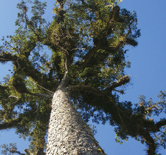
Podocarpus has exceptional flora; It is considered a huge botanical garden that owes its diversity to its geographical location in an area of confluence between the humid Andes of the north and the dier forests of the tumbesino regions of the south. It is estimated that the Park is home to between 3,000 and 4,000 plant species. An important site is the area of San Francisco and Bombuscaro (in the province of Zamora), where there is an interesting combination of species of Amazonian lowlands and Andean areas. Low woodlands of pituca, soda, carunga, cashco, duco y latero are typical. In these habitats there are varieties of rosemary and the árbol de cascarilla or cinchona. The area of San Francisco includes several species of important orchid, many of them endemic and highly ornamental. Podocarpus is also considered by bird lovers as a place of great diversity, with over 622 species recorded. You can find species including wild turkeys, 'crag cockerels', parrots, hummingbirds, toucans, tanagers and several species of raptor. There are also species of dwarf deer, cougar, deer and several mountain wolf species. There are large populations of spectacled bears, spider monkeys and tapirs, as well as countless species of amphibians and reptiles including cutines, jambatos, some glass frogs and one species of lizard named after the park (Anolis podocarpus).

Lagunas del Compadre
These lagoons are one of the main attractions of the park. It is a highly recommended as a place for lovers of sport fishing and adventure. The best time to visit this area is in November, when you can camp on its shores and roam around. With any luck you can observe some relatively common species in the sector, as the mountain tapir or mountain wolf.
Cajanuma
In the area of Cajanuma there is a reception center for visitors with information about the park. It is also the main entry point to the path that leads to the Lagunas del Compadre. And it has some self-guided interpretive trails where you can see the representative flora of the area, especially the cloud forest and a moorland typical of the Park It is a place of great importance for the observation of species of birds and mammals of the highlands.
Bombuscaro and Romerillos
Two areas in the eastern sector of the park. In Bombuscaro there is an environmental interpretation center and multipurpose room for educational activities. This site has established some self-guided tours to observe flora and fauna typical of the sector trails. A main attraction is the natural waterfalls that originate in the highlands of the park. It is a highly recommended site for photography and bird watching.
Cerro Toledo
Located at the southern end of the park, 12 kilometers from the Yangana - Valladolid road, Toledo hill is an important natural viewpoint from where you can see the forest and the typical topography of the country's southern Andes. It is a strategic site for observing birds and some mammals.


Clothing. Highlands(Cajanuma): warm clothes, waterproof poncho, sweater or raincoat in case of rain or drizzle. Proper footwear, good walking boots if undertaking medium or long walks. Foothills (Bombuscaro): light clothing and rubber boots for walking on trails in the area.
