
Description
Geography
Biodiversity
Main
attractions
Activities
allowed
Existing
facilities
Documents and
recommendations
How to get?
Colonso Chulapas is located within the regions of Archidona and Tena, between the Antisana Ecological Reserve and LlanganatesNational Park, forming a natural corridor in the upper reaches of the Amazon basin.
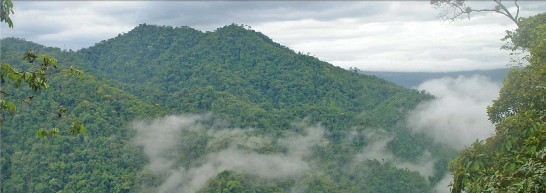
This reserve protects the watershed of Colonso, Tena, Inchillaqui and Shiti rivers and harbors ecosystems ranging from the Amazonian lowlands to wilderness areas in the upper reaches. This area is host to a vast diversity of flora and fauna, and their ecosystems provide important environmental services for the province of Napo, mainly in terms of water supply. Its very irregular topography has meant that it has been maintained over time and is in good condition. Its biodiversity and unique landscapes have great tourism potential.
There are no large population centers near the protected area; however, there are Kichwa and mestizo populations in the buffer zone who are engaged in agricultural activities and livestock.
From Quito: Get yourself to the Aeropuerto viejo (old airport) district of the city of Tena, where you take the Muyuna-Comunidad de Atacapi sealed road for about about 25 kilometers and 15 minutes of driving until you reach the IKIAM University. From this point take the unsealed bumpy road to Alto Tena. When you reach 'Sector Y' continue for about 3 km and 5 minutes where you'll reach the Colonso river, where the water catchment tanks for the city of Tena are located. From this point you can enter the forest trails.
Ministry of Environment / Provincial Directorate of Environment - Napo.
Av. Antonio Vallejo via the new cementery. Tena. Napo Province.
(06) 288-7154 / (06) 287-0077

The area contributes to the conservation of the headwaters of the Amazon basin ecosystems and eastern deserts and mountain forests. It has steep slopes that rise irregularly, with many gorges that collect high rainfall from the forest, feeding abundant and crystal clear Tena, Chalupas and Colonso rivers.
These rivers are on the eastern slopes of the Andes known locally as Guacamayos (macaws).
Because it is a newly created area, it has no facilities for sightseeing. The visit with scientists and research purposes must be requested and coordinated with the Ministry of Environment.
The east side of the protected area, in what was once the Colonso Protected Forest, has several trails with a total length exceeding 10 km and a gazebo with tourism potential, from where you get views of the city of Tena

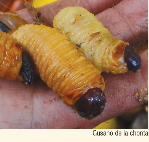
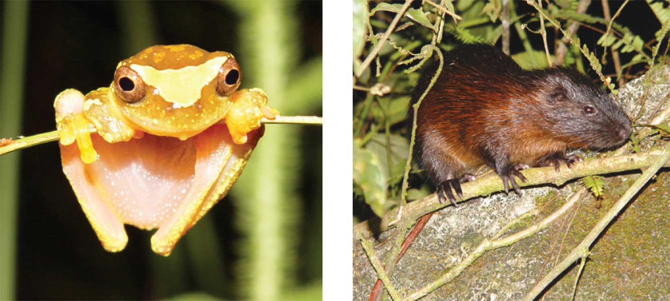
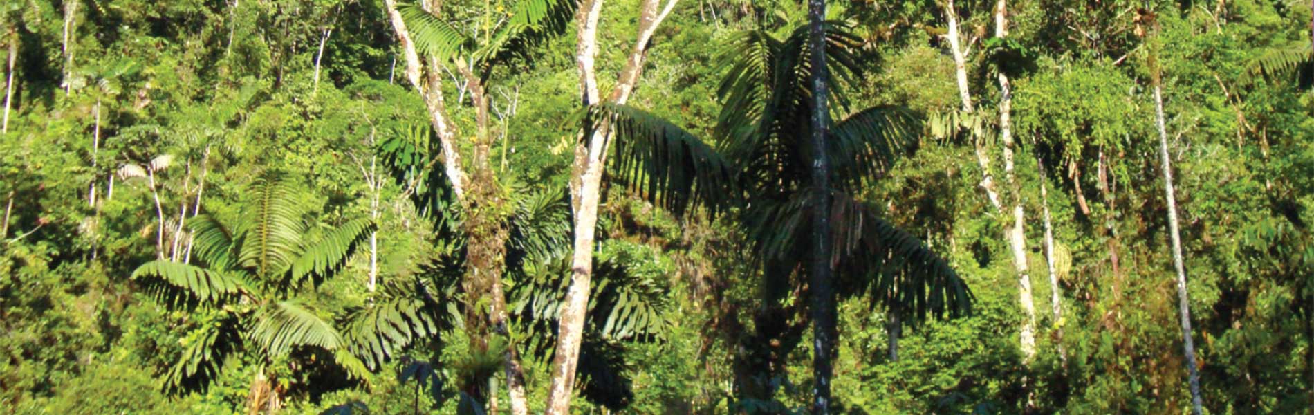
Colonso - Chalupas protects mainly moorland and mountain forests of the Amazon foothills. In the forests there are trees over 400 years old, which slowly grow to over 1 m diameter; the Chuchos for example, make up some of the highest treetops of the forest, and in them live a significant variety of birds. Furthermore, within the forest you can still find cinnamon and ishpingo trees,natives to the area. The cinnamon is a hard wood, ofetn felled for the construction of houses. So far, 40 edible fruits have been recorded in this area. The Pambil has multiple uses: traditionally the leaves were used to make hunting arrows, and now they are used in craft, and from their trunks the chontacuro is collected, an edible larva.
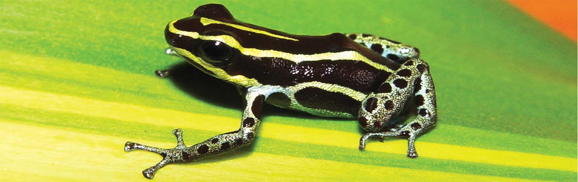
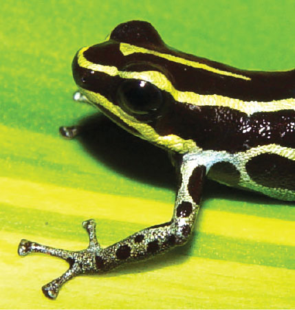
In terms of fauna, the standouts here are the amphibians; just one of its species, the ventrimanchada poison frog (Dendrobates ventrimaculatus) is represented in the logo of the reserve.

The main resources and attractions of the area are the great diversity that exists in the Amazon mountain forests and areas of outstanding natural beauty and recreational value as rivers and gunpoint. However, there is a definite lack of access roads, and as a result if is night on impossible to reach a lot of of these places.
Therefore, its main value for recreation and tourism is the landscape; to have spacious mountainous areas covered in a range of native vegetation. This can be seen in the area called Guacamayos on the Baeza - Archidona road; this area is almost always covered by a thick fog under which a diverse and teeming forest environment hides.


Clothing. High altitude: warm clothes, rain poncho sweater or raincoat in case of rain or drizzle. Proper footwear, walkbing boots if undertaking medium or long walks. Lower altitudes: light clothing and rubber boots for walking on trails in the area.

