

Description
Geography
Cultural
aspects
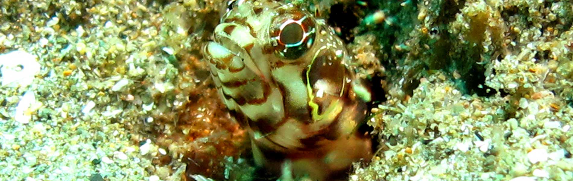
Biodiversity
Main
attractions
Activities
allowed
Existing
facilities
Documents and
recommendations
How to get?
This protected area is named after the Pacoche hills, located on the San Lorenzo cape south of Manta, the most protruding tip of the Manabi province. These small elevations do not exceed a height of 363 metres, but its location (in the coastal transition area of dry and humid environments) generates ideal conditions to shelter dry forests and slightly more humid ones, called garua forests.
The refuge protects 5,045 hectares of terrestrial ecosystems and 8,500 hectares of coastal marine ecosystems, an ideal combination of land and sea. The protected area borders several towns located on the coastline: San Lorenzo, Rio Cañas, Las Piñas y Santa Rosa. In the most influential areas are the towns of Pile, Santa Marianita and Liquiqui on the coast, while further inland you have the towns of El Aromo, and Pacoche. The sites of La Solita and Agua Fria are located within the protected area.

From Guayaquil. Take the Daule route until you reach Nobol (41 km), from where you take the route to Montecristi, towards the city of Manta (161 km); from here take Ruta E5 going south (21 km), passing through Comuna El Aromo, in the bollos and tongas restaurant area you´ll find the entrance to the Pasaje del Mono trail and also to the protected are.
From Santa Elena, take the route Spondylus until you reach Puerto Lopez (145 km), from where you take the route to Puerto Cayo (26 km), continue on the route to Manta and in 40 kilometers you´ll find the San Lorenzo parroquia. From here you can access the visit sites of the protected area.
From Quito. First you have to reach the city of Manta. From here you take the Ruta E5 route going south (21 km), passing through Comuna El Aromo you will reach the entrance to the protected area.
Main entrance to Refineria del Pacifico, after the first guard gate take a right and continue for about 2 kilometres. Comuna El Aromo. Provincia de Manabi.
(05) 263-8857 Provincial Directorate of the Ministry of Environment

This protected area is located in the central region of the Manabi province, in the mountains and hills system of the San Lorenzo cape, 26 kilometres south of Manta.
The terrestrial environment of this reserve is comprised mainly of the Pacoche hills and other lower areas. Streams flow from these hills towards the interior of the province, such as the rivers of Cañas and Napos, and the estuary Agua Fria.
Towards the west, there are more than 10 ephemeral rivers, that is to say, they dry up during summer but remain flowing throughout the rest of the year providing vital water to the surrounding towns and to the wild species that inhabit this area. The west foothills of the main hill of Pacoche comprise more than half of the surface area of the reserve.
The marine area is located on the continental platform and comprises a great diversity of coastal-marine environments: soft seafloor continental shelf, hard seafloor continental shelf, rocky reefs, rocky beaches, sandy beaches, mixed beaches and cliffs.
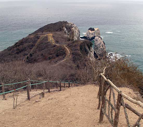
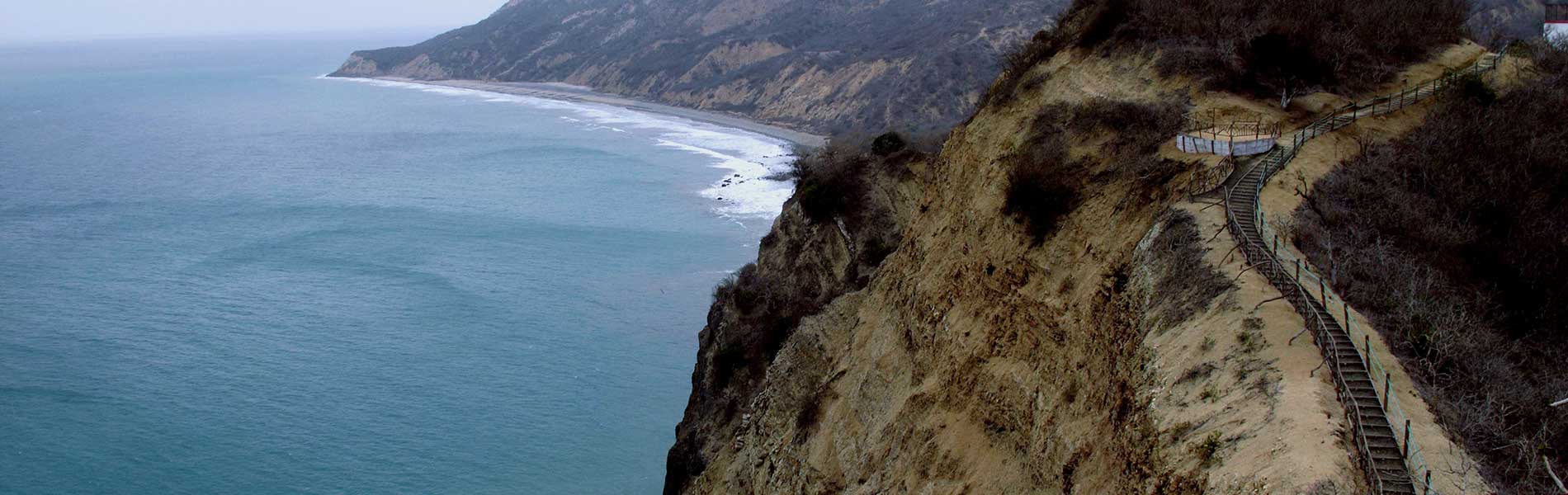
El Faro Trail is a 1 kilometre trail that runs through the arid forest area, with a natural gazebo in the cliff area. It´s a medium difficulty trail due to steps with rope walkways. In this trail the beautiful view of the cliffs and of the protected marine area can be appreciated.
Pasaje del Mono Trail. This is a 1,5 kilometre trail that runs through the rain forest, where on occasions it is possible to observe howling monkeys at a short distance. It´s a medium difficulty trail due to steps with rope walkways. It is mandatory that the visit be accompanied by a tour guide.

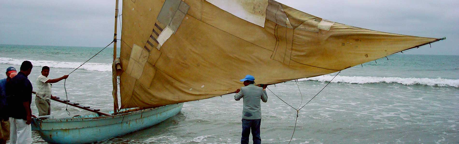
Since ancient times the terrestrial and marine biodiversity allowed the survival of ancient inhabitants by providing food, shelter, and various utensils for daily life. The groups that have inhabited this area have developed management practices that luckily have not destroyed the vegetation of the surrounding hills. Their inhabitants have incorporated interesting agroforestry practices, such as the shadow growing of fruit, cacao and coffee; they have also dabbled in the growing and management of native species such as tagua and paja toquilla, from which several artisan crafts are made.
These ancient management practices allow for the vegetation of these hills to maintain theyir ecosystem function: to capture the environment´s humidity and form its various streams. These aspects, among others, are what motivated the declaration of this site as a Protected Forests and Vegetation site by the Manta Municipality. Subsequently, once the vast wealth of terrestrial and coastal-marine wealth becmae better known, the forest and the surrounding marine area were named as a Wildlife Refuge.
Tortugas marinas del Pacífico
Un grupo importante de animales que ha encontrado refugio en esta área son las tortugas marinas. Durante la época de anidación, las hembras llegan a la zona de playas de arena para depositar sus huevos. Las playas de San Lorenzo y la Botada son importantes lugares de anidación de la tortuga golfina y la tortuga verde. También existen registros (en la playa de San Lorenzo) de nidos de tortuga laúd, la tortuga marina más grande del mundo. Los estudios que se realizan en el área protegida y sus zonas de influencia indican que en las playas de Liquiqui, Santa Rosa y Santa Marianita -aunque en menor medida- también son lugares de anidación de estos singulares reptiles.

Garua Forest
It is possible to access the garua forest from various sites of the already mentioned towns. There you can observe several types of birds and in some occasions howling monkeys. Because of the great variety of birds, this forest has become a frequent destination for birdwatching in Ecuador. There are local tour guides that know the trails very well and facilitate the touristic experience.
Beaches and cliffs
The coastal line annexed to the reserve is comprised with 13 kilometers of sandy and rocky beaches, as well as large cliffs equally attractive. The main beaches are Liquiqui, San Lorenzo, San Jose and Santa Marianita.
Marine turtles nesting
The San Lorenzo beach is part of the protected area and it´s an ideal resting site for its tranquility. Additionally, it is high nesting season during the months of September and December and it is possible to observe baby turtles emerging from their nesting sites and heading to the sea.


Clothing. Light clothing for hiking in the trails of this area.
Precautions. To hike the El Faro trail, it is recommended to keep a safe distance at the borders of the cliffs to prevent accidents.

