
Description
Geography
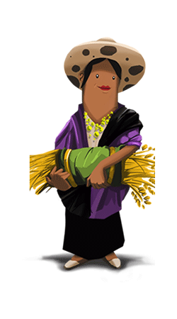
Cultural
aspects
Biodiversity
Main
attractions
Activities
allowed
Existing
facilities
Documents and
recommendations
How to get?
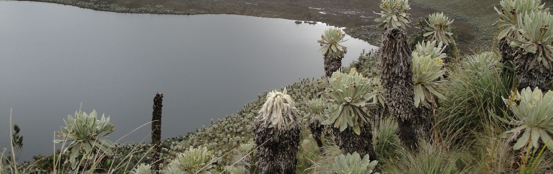
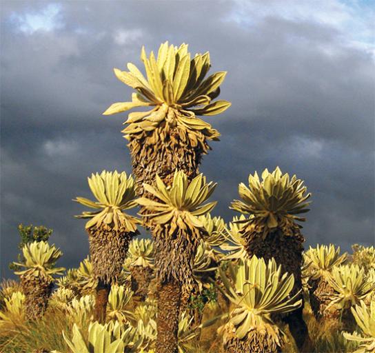
A battalion of millions of flora species equipped with the most extraordinary abilities defy the rigorous weather conditions on the high moorlands of El Angel. The most representative plants of this protected area are the frailejones (or espelatia). They have a rosette crown of leaves which are covered by whitish hairs that protect from the cold, repel water and reflect solar radiation because of its velvety texture they are also known as “orejas de conejo” (bunny ears). This type of moorlands are mainly located on the Andes of Venezuela and Colombia; but also this northern patch of Ecuador in Carchi and an isolated town within the National Park Llanganates, on the east-central mountain range. The moorlands in El Angel are very humid and have many lakes that provide water to much of the Carchi province. In the absorption area of the reserve there are polylepis forests, a type of tree that has a reddish crust and whose trunk is flaky. Deer, condors, and curiquingues roam throughout the whole area.
Ramsar SIte declared in 2012
From Quito.
From Quito. Take Panemericana Norte, going through Ibarra (123 km); on the police control area of Mascarilla, 30 km from Ibarra, take the road to El Angel (35 km).
From El Angel.
Take a well-maintained road until you reach La Libertad. Continue on a less well-maintained road, for 13 km and 45 minutes of travel will get you to the forest.
To Laguna (lagoon) de El Voladero. 17 km from El Angel (crossing through the town of Cavayan) take a road in good condition. Then you will proceed on to a less well-maintained road to arrive to El Voladero.
From Tulcan.
To Lagunas Verdes and Chiles. Agood road takes you to the town of Tufiño. From here to the lagoons you take a road that is less well-maintained.
Streets Riofrio and Sucre. El Angle. Carchi Province.(06) 297-7597
(06) 297-7597

The Ecological Reserve El Angle is located in the western Andes and in the northwest of Ecuador, in the Carchi province that borders with Colombia. It crosses the old road that unites the town of El Angel with Tulcan, the provincial capital. In this area the two mountain ranges, separated towards the south, begin to fuse with the massif gnarl of Pasto. There are protruding imposing volcanos such as the Cumbal of Colombia and the Chiles, just over the border line. There are areas with steep slopes and breathtaking cliffs, under which great plains extend. In this scenery, sculpted by volcanos and glaciers, is where the wilderness straw, the frailejones, and endless plants and animals that have adapted to tropical heights grow seemingly without a problem. The reserve also protects the nascent of several rivers that feed the El Angel river, among which we find the rivers of Potrerillos, Rosococha, Chilma, Grande, Santiaguillo, and Voladero.
On the wardens of El Salado and El Voladero picnic and camping are available. The protected area has several trails:
El Voladero. A selfguided trail of 2.5 kilometres that surrounds the lagoon.
Bosque de Polylepis. A 3 kilometre trail that runs from the forest to the Negra lagoon, goes through Cienegas Amarillas and the Puermal river. Medium difficulty trail that requires a tour guide.
Represa Geovanny Calles. An 800 mere trail from the Geovanny Calles dam to a gazebo, runs through a thick forest of frailejones, on some occasions condors are visible. Low difficulty.
Voladero-Tufiño. A trail of advanced difficulty. The 7 kilometres run through the Potrerillos lagoons, and Andean forest, frailejones and some rivers. Sport fishing is available in this area. A tour guide is required.
Loma Guipa-Baños. A 3 kilometre trail that allows you to get to know the river Baños. thermal waters of Baños, Polylepis forests and frailejones. It´s a medium difficulty trail that requires the assistance of a tour guide.

The current reserve was originally part of the territory of a pre-Inca indigenous group, the Pastos or Past-Awa, apparently closely related to the current indigenous group of Awa of lower lands towards the west. Los Pastos posed arduous resistance against the onslaught of Huayna Capac, only to fall before the Spaniard attacks. Today there is a great rebirth of the Pasto culture among the habitants that surround the reserve. Many names of places and last names of this area are testament to this past, and we can even find petroglyphs and other signs of ancient occupation in the vicinity of the reserve. After the conquest and colonization, there were great ranches in the area, some of which remain, even though many of them are in hands of the community. Two communities, La Libertad and 23 de Julio, occupy more than two thirds of the reserve, and its members are very interested in maintainting the sustainable management of the moorlands.
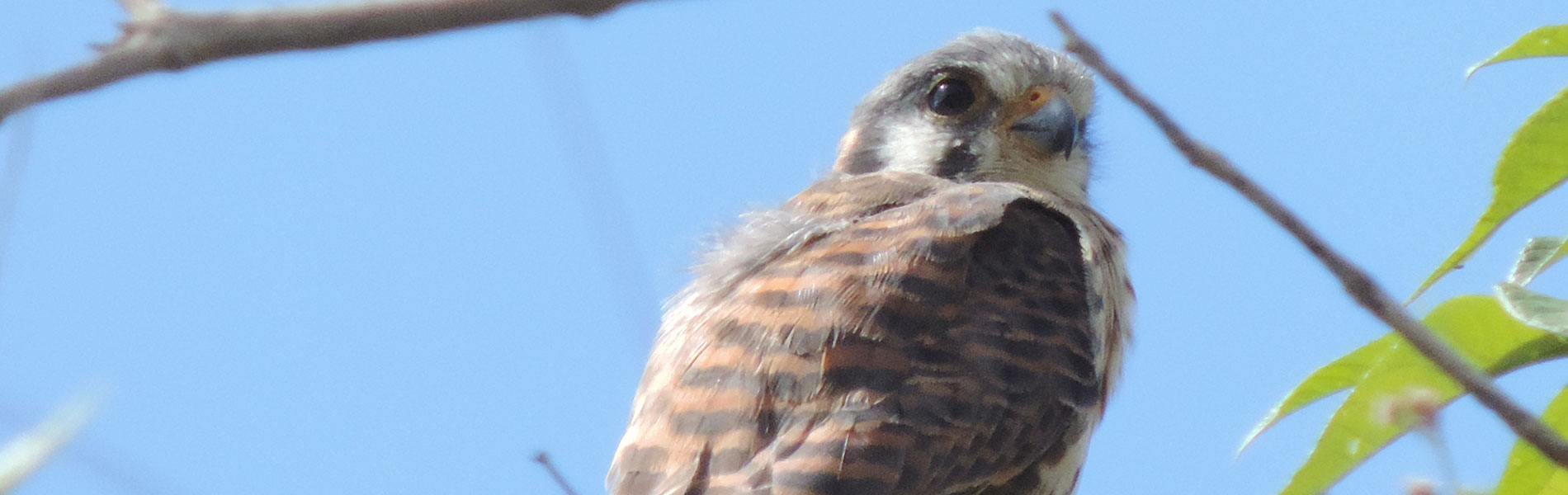
Within the reserve there have been more than 250 plant species registered. In the lower area, among the grass the failejones grow. There are also shrubbery such as senecios, ashpachocho, gencianas, chquiraguas, mortiños and zapatitos. Hojayakus and paraguas grow close to the water. There are also ferns such as the lengua de venado, an aquatic fern endemic to Ecuador. On the high areas, above 4,000 meters, the frailejones give way to different vegetation: almohadillas, equisetos or colas de caballo, romerillo, taruga and dedos de diablo. Native grasses grow around the lagoons, and within its waters you'll find are aquatic plants also. There are rainbow trout and brown trout, which are consdiered exotic and very invasive, and have had a great impact on the native fauna. Nevertheless, in 2001 there was a native fish recorded in the El Voladero lagoon. In the lagoons there is also several species of ducks and galleretas. On the moorlands we can find moorland wolfs, cervicabra, white tailed deer, pumas, bunnies, chucuri, and the Andean bear. In the lower areas we can find Andean guantas, foxes, and Andean porcupine. YOu might see condors, Andean gulls, several eagles, quilico, curiquingue, cuscungo owl, and several hummingbirds. There is also amphibian diversity in the moorlands, such as glass frogs, marsupial frogs, cutines frogs, as well as reptiles that include lizards and guagsas de El Angel.

Frailejones
The most outstanding and beautiful feature of the reserve that cover the moorlands. You can observe the infinite number even from the roads of access to the reserve and from the lagoons.
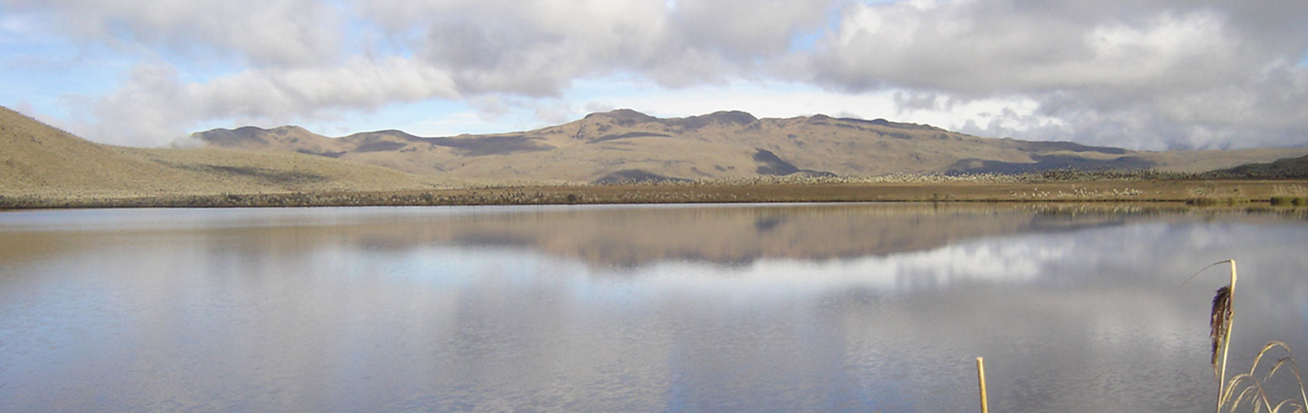
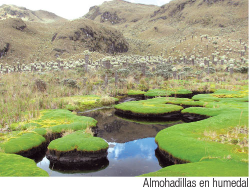
Lagoons
The lagoons of El Voladero are on the old road that runs from the town of El Angel to Tulcan; these swamps and lagoons cover almost 30 hectares. From here you walk north and arrive to Potrerillos, a pretty big lagoon that extends for almost 24 hectares. Others like the Yanococha or Negra are located on the southern skirts of Cerro Negro. On the south side of the reserve there are the lagoons of Crespo that cover almost 13 hectares. Some can be seen as just one lagoon, in the case of Potrerillos, Yanacocha and Negra. But others, such as those of El Voladero or the Verdes, are a group of lagoons with flooded areas in between that make it very difficult to be exact as to how many there are, or where one starts and the other ends.
Chiles Volcano (4,218 m)
Located on the Northside of the reserve, very close to the Colombian border, is an ideal site for those who like climbing. At its edges are the sufuring waters of the Lagunas Verdes; where sulfur mixes with algae resulting in a greenish turquoise color. The lagoons cover about 6 hectares.
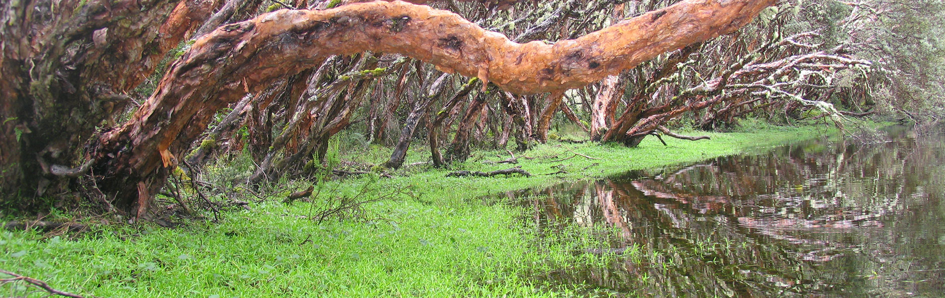
Polylepis Forest or Cañon del Colorado.
Polylepis is a generic name of several trees species that grow to great heights in the Andes, known as arboles de papel, quinoas, yahualesco pantzas. This forest, that looks like it came from a fable, is worth visiting due to the ancient mysteriousness of its trees.


Clothing. Requires warm clothes, water poncho or a waterproof swater in case of rain or drizzle. Appropriate shoes, mid-cut boot type shoes, in case of long or medium hikes.

